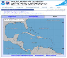
National Hurricane Center (NHC) Forecasts
National Hurricane Center, National Oceanic and Atmospheric Administration (NHC)
Hurricane
Weather
ACCESS INFORMATION
DATA ACCESS
https://www.nhc.noaa.gov/ACCESS TYPE
Open access
DATA FORMAT
- shapefile
OVERVIEW
RESOURCE DESCRIPTION
The NHC uses multiple weather forecast models and inundation models to predict a hurricane's intensity and track. Note that, in the case of NHC Forecasts, some upstream models are also downstream as they are re-run approximately every 6 hours during an event based on updated forecast data. Additionally, there are unlisted upstream models that almost exclusively feed these forecasts and are not often independently used, including CLIPER5, SHIFOR5, BAM, SHIPS, and the CMC GEM model. The UKMET global weather forecasting model also feeds NHC Forecasts.
BROAD DATA CATEGORIES
- Public information / Safety
SPECIFIC DATA ELEMENTS
- Hurricane
- Weather
RESOLUTION
GEOGRAPHIC COVERAGE
US States; Puerto Rico; US Virgin Islands
